Saturday, May 24, 2014
Hiking West Virginia: Dolly Sods
We took Thursday and Friday off, and traveled south. Thursday, we hiked Dolly Sods, which ended up being far less pleasant that it sounds, because 1) it rained for about 3/4 of the hike 2) it’s been raining for most of May and 3) about 2/3 of the way through our hike, the trail went through a swamp. And it’s been raining a lot.
Location: Dolly Sods National Wilderness Area
Trails: Blackbird Knob Trail, Upper Red Creek Trail, Dobbin Grade Trail (swamp), Beaver Dam Trail, and then Forest Road 75 back to the Blackbird Knob Trailhead)
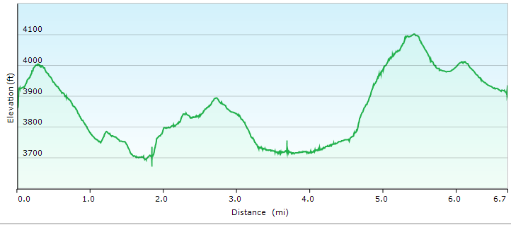
Distance: 6.7 miles
Elevation: 838 feet
Here is what part of the non-swamp portion of the trail–the Upper Red Creek Trail–looked like:

Here’s another view of the Upper Red Creek Trail area. Yes, it was raining. And raining. And raining.

This is part of the Blackbird Trail, and approximately where we made the mistake of turning onto the Upper Red Creek Trail. Which would eventually lead us into the swamp.
I admit that even in the rain the Blackbird Trail was beautiful.


Here are the remains of the swamp I took out with me.

Dolly Sods Trails Hike (gps map)
After we finished our hike? The rain stopped, the skies cleared, and it was beautiful.


