Hiking WV: New River Gorge: Kaymoor Miners Trail
Saturday was gorgeous, so we went to New River Gorge. We’ve gone to Bridge Day in previous years, but hadn’t spent any time hiking the gorge, and so didn’t realize just how many miles of trails there were.
We are going back again, hopefully many times.
Location: New River Gorge
Trails: Kaymoor Miners Trail, Arrowhead Trail (Clovis)
Distance: 4.0 miles
Elevation: 1228 feet
The top part of this trail is steep and rocky, but very beautiful. The recent rains meant the creeks and streams were full and since we were going down the side of the mountain, there were plenty of waterfalls both large and small.


Because the trees are just starting to leaf out, you can still see the river and down into the gorge.

The lower part of the trail is all steps.

More than 800 steps.
But at the bottom, were the remains of the processing plant, coke ovens, and town, which were fascinating.


GPS Map
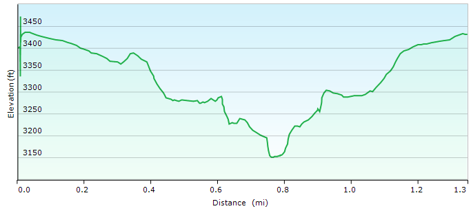
Elevation Chart:

(the place where it flattens out is where we took the Clovis Arrowhead trail, so we could stretch our legs)
How it came out on FitBit:


