Random (but not really)

Sunday, September 22, 2019

Sunday Flower Pr0n: Cranberry Glades

Late September is when the earliest leaves change color in areas like Cranberry Glades and Dolly Sods and Canaan Valley. Since I love Cranberry Glades best that’s where we went.

Not much in the way of leaf color, but a beautiful day nevertheless.

2019-09-21_Cranberry_049

2019-09-21_Cranberry_072

2019-09-21_Cranberry_068

2019-09-21_Cranberry_042

2019-09-21_Cranberry_078

2019-09-21_Cranberry_081

Written by Michelle at 6:59 pm    

Comments (0)  Permalink

Categories: Flowers,National Park / Forest,Photos,West Virginia  

Sunday, September 1, 2019

Jackson’s Mill

Went south yesterday for the Jackson’s Mill Jubilee. As noted in previous years, there are fewer crafters each time we visit. But lots of live music–and I saw quite a few younger musicians alongside the old bearded dudes.

Since we were wasting time waiting for the start of the game so we could go home, I spent lots of time wandering around the mill.

I love that place So. Much.

2019-08-31_Jacksons_Mill_001

2019-08-31_Jacksons_Mill_019

2019-08-31_Jacksons_Mill_009

2019-08-31_Jacksons_Mill_025

2019-08-31_Jacksons_Mill_006

2019-08-31_Jacksons_Mill_004

Written by Michelle at 4:37 pm    

Comments (0)  Permalink

Categories: Photos,State Park / Forest,West Virginia  

Sunday, August 25, 2019

Hiking WV: Blackwater Canyon

As I mentioned previously, the monitor on my Asus laptop died, so although we did take a lovely hike a couple weeks ago at the Cranberry Wilderness, I did not manage to write about it or post any pictures.

This weekend Michael was still recovering from the start of school (couple weeks of 10-12 hours days. Ugh.) so we didn’t want to go far, so the Blackwater Falls / Canaan Valley area it was.

I remembered that it’d been a couple years since I’d taken any pictures of Douglas Falls, so that’s where we headed, and then continued out the defunct rail trail (it’s private property, so the trail is not maintained for 5 1/2 miles, but it was perfectly fine to hike).

The fun part was our argument as to whether Michael has seen Pace Point or not. I’m pretty sure he didn’t. We did definitely see Lindy Point though. (We’ve argued for years as to whether you can see Lindy Point from Pase Point. I say definitely not.)

Location: Blackwater Canyon Rail Trail
Distance: 6.2 miles (partial, out and back)
Elevation: 2755-2918 feet (410 feet gain)

Definitely Lindy Point, as seen from across the river.

2019-08-24_Blackwater_Canyon_073

This is what Michael says is Pase Point. I say NOPE.

2019-08-24_Blackwater_Canyon_084

The old coke ovens along the trail are AMAZING.

2019-08-24_Blackwater_Canyon_114

It’s actually a lovely trail.

2019-08-24_Blackwater_Canyon_071

2019-08-24_Blackwater_Canyon_091

Douglas Falls

2019-08-24_Blackwater_Canyon_045

Lovely!

Written by Michelle at 8:49 pm    

Comments (0)  Permalink

Categories: Hiking,National Park / Forest,Photos,West Virginia  

Monday, June 24, 2019

Hiking WV: Blackwater Canyon

I’ve been sickly for about two weeks, getting over some kind of cold/respiratory thingy. So yesterday we wanted to hike somewhere close, and take a hike that wasn’t too strenuous.

Apparently, we have a strange definition of strenuous.

We ended up going to Thomas/Davis because it’s a short-ish drive, and there are tons of places to hike. We were considering the Canaan Wilderness, but I looked through the hiking books on the way down, and decided we should try some more hiking in the Blackwater Canyon (across the gorge from Blackwater Falls State Park).

Location: Blackwater Canyon
Trails: Allegheny and Limerock Trails
Distance: 8.2 miles
Elevation: 2863-3118 feet (590 feet rise)

It seems that for us, 8.2 miles turned out to be taking it easy. We did have a much slower pace than we normally hike (30 min mile vs 20 min mile) and the majority of the hike was on a railroad grade trail, so it was a slower elevation rise. Essentially, we parked, and hikeed out until we decided we were ready to turn around.

The temperatures were perfect for hiking, the weather was lovely, and aside from one dirt biker on the RR grade trail, we didn’t see anyone else while we were out.

So: a good day.

2019-06-22_Blackwater_Canyon_004

2019-06-22_Blackwater_Canyon_021

2019-06-22_Blackwater_Canyon_020

2019-06-22_Blackwater_Canyon_007

Written by Michelle at 6:00 am    

Comments (0)  Permalink

Categories: Hiking,National Park / Forest,Photos,West Virginia  

Sunday, June 23, 2019

WV Roads

I’ve talked about WV roads before, and I truly don’t think most people really get it.

US Route 50 stretches from the east coast to the west coast. It was constructed in the mid 1920s. So it’s been around for awhile and used to be a major thoroughfare.

West of I79, US 50 in WV is relatively straight, and for the most part a divided highway. East of I79 it is two lanes, 7-11% grades, and hairpin turns. The GPS often loses signal along the more winding stretches and has us either inside the mountain or floating above the gorge. (“Damnit! You’re off-roading again!”)

When I talk about reasons why WV has trouble getting jobs because of lack of infrastructure, US 50 East of I79 immediately comes to mind. No one in the right mind would bring production into an area where you cannot drive large trucks.

So in an effort to try and explain WV roads, here is a small section of US 50, taken over approximately 5 minutes, up to and then down one of my least favorite stretches of US 50. (This is NOT the section with the switch backs.) I named the pictures with the date and time, and all should have GPS coordinates.

Ready? Here we go!

18-55-00. Coming up to the top of the mountain, there are multiple signs warning trucks about the hill. “Trucks must stop 1/4 mile”

18-55-16. “Trucks must stop 1000 FT”

18-55-27. “ALL TRUCKS”

18-55-39. “Trucks. 20 MPH Curve Bottom of Grade.”

Oh yeah, this section of downhill ends in a sharp curve.

18-56-03. Here we go!

18-56-20. “Rough Road”

Because of course the road is subsiding.

18-56-55

18-57-12.

18-57-15. “9%”

18-57-27.

18-58-46. “30 MPH”

18-59-12.

18-59-23. “9%”

18-59-45.

19-00-13. “9%. 1/2 MILE”

19-00-39. “20 MPH”

That’s the final turn and now you’re down in the valley.

Five minutes. 9% grade. And it you mess up you’re smashed into the side of the mountain or plunging into the gorge.

These is a US route, not a county road. THIS is why we can’t get jobs in WV. Not because the people are unwilling to work, but because businesses can’t GET to the areas where jobs are needed.

Written by Michelle at 6:19 pm    

Comments (0)  Permalink

Categories: Photos,Politics,West Virginia  

Saturday, June 8, 2019

Summer Food Programs

USDA: Find Summer Meals in Your Community

Nutritious free meals are available for children and teens 18 and younger at many locations throughout the nation throughout the summer while school is out of session. Use the mapping tool below to find a site near you.

Mountaineer Food Bank

Mountaineer Food Bank is located in Gassaway, WV. Our organization provides food and other household items to our emergency food network in 48 counties including programs such as food pantries, soup kitchens, shelters, Backpack programs, senior programs and mobile pantries.

MFB works with the West Virginia Department of Agriculture to distribute USDA commodities in 43 counties in West Virginia, almost 3.5 million pounds annually. The products are generally staple items such as green beans, corn, canned fruit, juices and proteins such as meat or peanut butter.

Written by Michelle at 10:01 am    

Comments (0)  Permalink

Categories: Politics,West Virginia  

Tuesday, May 28, 2019

Hiking WV: Seneca Rocks

Sunday was our annual hike up Seneca Rocks in memory of my cousin Ben. Ben died in 2012, and every year since then we’ve hiked up Seneca Rocks on his birthday. And since we’re doing it in memory of Ben, we have to go all the way to the top without stopping.

I was chatting with Tania the night before, and she asked if I was still mad at Ben. I said much less than I had been.

I changed my mind about 2/3rds of the way up.

I’m not as mad at him as I used to be (once I catch my breath, that is) but it’s still hard for me to accept. And it most likely always will be.

Although there was rain throughout the day, it held off for our hike, as well as while we were enjoying the view.

Location: Seneca Rocks
Distance: 3.6 miles
Elevation: 1546-2407 feet (919)
Temperature: 75 F

Hike up:
Distance: 1.2 miles
Elevation: 1578 – 2319 feet (740); 11.6% grade
Time: 32 minutes

2019-05-26_Seneca_Rocks_067

2019-05-26_Seneca_Rocks_016

2019-05-26_Seneca_Rocks_024

2019-05-26_Seneca_Rocks_026

Written by Michelle at 6:00 am    

Comments (0)  Permalink

Categories: Family,Hiking,National Park / Forest,Photos,West Virginia  

Monday, May 20, 2019

Hiking WV: Canaan Valley

We’d hoped to spend some time hiking in the southern part of the state after I finished teaching in Charleston, but thunderstorms nixed that plan, so we came home, and had a day trip to Canaan.

This is one of the places we go frequently, because it’s relatively close to Morgantown, and there are SO MANY places to hike.

Location: Canaan Wilderness
Trail: Lindy Run, Plantation, Fire Trails
Distance: 4.0 miles
Elevation: 3459-3652 feet (397 feet gain)
Temperature: 82 F

Wet trail.

2019-05-18_Canaan_Wilderness_001

Wet crossing.

2019-05-18_Canaan_Wilderness_012

Dry trail.

2019-05-18_Canaan_Wilderness_011

Gorgeous creek.

2019-05-18_Canaan_Wilderness_013

Written by Michelle at 7:44 pm    

Comments (0)  Permalink

Categories: Hiking,National Park / Forest,Photos,West Virginia  

Sunday, May 19, 2019

Sunday Flower Pr0n: Canaan Valley Edition

Our original plans for the weekend were thrown into disarray, so we went to Canaan Valley on Saturday for a little hiking, and to see what spring wildflowers were out.

Answer: lots and lots.

2019-05-18_Canaan_Valley_009

2019-05-18_Canaan_Wilderness_005

2019-05-18_Canaan_Valley_021

2019-05-18_Canaan_Valley_007

2019-05-18_Canaan_Valley_025

Sunday, May 12, 2019

Sunday Flower Pr0n: Cacapon State Park

I really want an app that gives me the forecast for the state and tells me where it will NOT be raining over the weekend. Is that really so much to ask?

The forecast looked least wet in the Berkeley Springs area, so we headed east to do some hiking at Cacapon.

2019-05-11_Cacapon_013

Irises

2019-05-11_Cacapon_007

Pink Lady Slipper

2019-05-11_Cacapon_009

FUTURE SNACKS!!!!

Written by Michelle at 9:25 am    

Comments (0)  Permalink

Categories: Flowers,Photos,State Park / Forest,West Virginia  

Tuesday, April 30, 2019

Hiking WV: Cranberry Wilderness

The boardwalk is lovely, but .8 miles and flat is not a hike, so we decided to go out a bit on the Cow Pasture Trail, in the hopes there would be wildflowers.

There are LOTS of wildflowers.

We hiked parts of the other end of the trail, but hadn’t walked any of the western part of the trail.

It was gorgeous.

There are so many trails I want to hike in the Cranberry Wilderness, but most of them are long and would require an overnight stay–which we can do, but haven’t been able to do. (Because rain, work, reasons.)

Location: Cranberry Wilderness
Trail: Cow Pasture Trail
Distance: 4.9 miles
Elevation: 3347-3462 feet (364 feet rise)
Temperature: 59 F

2019-04-27_Cranberry_101

2019-04-27_Cranberry_102

2019-04-27_Cranberry_086

2019-04-27_Cranberry_084

Written by Michelle at 6:00 am    

Comments (0)  Permalink

Categories: Hiking,National Park / Forest,Photos,West Virginia  

Monday, April 29, 2019

Hiking WV: Cranberry Glades

If you haven’t been (and really, why haven’t you?), Cranberry Glades is an amazing area. It’s an area of bogs with plants typically found much farther to the north (like Canada).

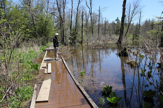
It’s a very brief walk, and usually handicapped accessible, however, a section of boardwalk currently needs repaired, due to beaver activity.

It was a gorgeous day, and there were quite a few people on the boardwalk (by quite a few, I mean there there were about six cars in the parking lot).

If you have the chance, head there now, while the flowers are in bloom.

Location: Cranberry Glades
Trail: Cranberry Glades Boardwalk
Distance: 0.8 miles
Elevation: 3620-3659 feet (46 feet rise)
Temperature: 55 F

2019-04-27_Cranberry_062

2019-04-27_Cranberry_050

2019-04-27_Cranberry_047

2019-04-27_Cranberry_057

Written by Michelle at 6:00 am    

Comments (0)  Permalink

Categories: Hiking,National Park / Forest,Photos,West Virginia  

Sunday, April 28, 2019

Sunday Flower Pr0n: Cranberry Glades

Our last hike (Canaan & Blackwater Falls) were a dud as far as spring wildflowers went.

Our trip to Cranberry Glades was FULL of wildflowers. It was a gorgeous day.

2019-04-27_Cranberry_017

Swamp cabbage Symplocarpus foetidus

2019-04-27_Cranberry_002

Marsh Marigold Caltha palustris

2019-04-27_Cranberry_009

2019-04-27_Cranberry_039

Pitcher Plants Sarracenia

2019-04-27_Cranberry_079

2019-04-27_Cranberry_081

Trout lily!

2019-04-27_Cranberry_072

Trillium!

Written by Michelle at 11:15 am    

Comments (0)  Permalink

Categories: Flowers,National Park / Forest,Photos,West Virginia  

Wednesday, April 17, 2019

Hiking WV: Blackwater Falls State Park

Not finding a lot of flowers at Canaan, we went to Blackwater Falls, in hopes some drier trails might have more wildflowers.

They didn’t, but it was a gorgeous day for a hike, so it’s still a win.

Location: Blackwater Falls
Trails: Elakala and Shay Trace Trails
Distance: 1.2 miles
Elevation: 3082-3228 feet (212 feet rise)
Temperature: 68F

Trails: Dobbins House and Pace Point Trails
Distance: 2.9 miles
Elevation: 2993-3160 feet (274 feet gain)
Temperature: 72F

We went out to Pace Point, in the hopes we’d see lots of flowers. Not many flowers, but still a lovely hike. Then we spent a bit of time at the top of Pendleton run.

2019-04-13_Blackwater_Falls_053

2019-04-13_Blackwater_Falls_061

And since we were on Elakala Trail, we of course scrambled down.

2019-04-13_Blackwater_Falls_016

2019-04-13_Blackwater_Falls_039

It was such a lovely day!

Written by Michelle at 6:00 am    

Comments (0)  Permalink

Categories: Hiking,Photos,State Park / Forest,West Virginia  
« Previous PageNext Page »

Powered by WordPress